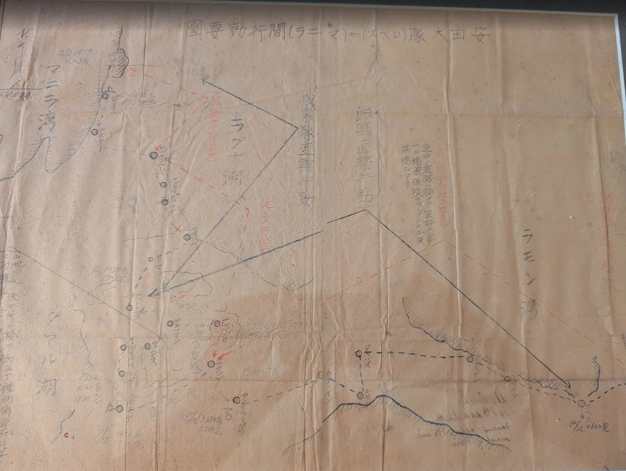
This rare historical document is an original Japanese operational map detailing troop movements on the island of Luzon during the critical final stages of the Pacific War in December 1944. The map outlines the tactical maneuvers of the 'Ota Detachment' (Ota Tai) as they navigated the terrain between Manila Bay and Lamon Bay.
The document features hand-drawn annotations, directional arrows indicating infantry and motorized unit routes, and specific geographic markers such as Laguna de Bay. At this stage of the war, the Imperial Japanese Army, under the command of General Tomoyuki Yamashita, was preparing for the inevitable American invasion.
The Luzon Campaign, which began in January 1945, was one of the largest and most complex amphibious operations of World War II, involving the U.S. Sixth Army under General Walter Krueger.
The annotations on the map provide a sobering glimpse into the logistical challenges faced by Japanese forces as they attempted to consolidate defensive positions against overwhelming Allied air and naval superiority. The document captures the desperation of the Shō-Go 1 (Victory) plan, which sought to defend the Philippines at all costs.
The map serves as a primary source for historians studying the tactical collapse of the Japanese defensive perimeter in the Philippines. It highlights the movement of units across rugged terrain, reflecting the intense pressure exerted by advancing Allied forces.
By December 1944, the strategic situation for Japan was dire, with supply lines cut and communication fragmented. This map remains a testament to the meticulous, albeit ultimately futile, planning of the Japanese military as they faced the impending liberation of the Philippines.